top of page

BF Terra - Group 01
Santo Antonio, Dona Bilica, Mexican and Mexican II Farms

Area Location
FIRM
Through the FIRMS platform
(Fire Information for Resources Management System) from NASA, Greenline tracks any fire outbreaks that may occur in areas of interest.

Indigenous Area
Greenline does not allow the use of land areas that overlap any indigenous lands, therefore through the FUNAI Monitoring Portal, it is demonstrated and proven here that the land areas do not overlap indigenous lands.


PIGMENTATION ANALYSIS
2024


1/11
2023


1/10
2023

G01

G02
G11
G01
1/11
2023


1/11
2023


1/9
2023


1/12
2023


1/9
2023


1/9
2023


1/9
2023


1/11
2014


1/9
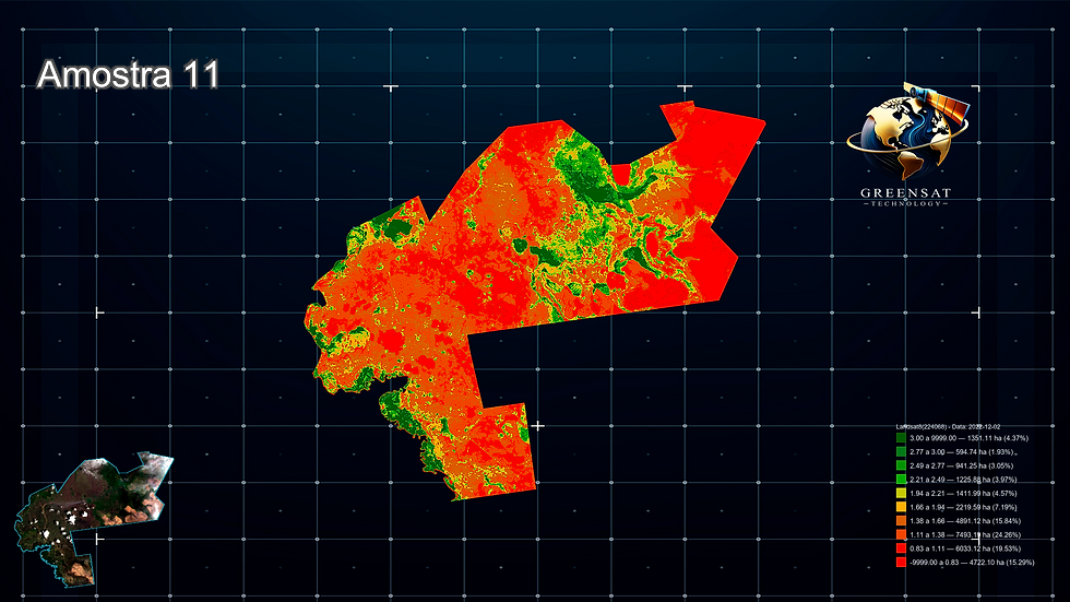
CARBON SEQUESTRATION
2024


1/11
2023


1/10
2023

AMOSTRA 01

AMOSTRA 02

AMOSTRA 11
AMOSTRA 01
1/11
2023

AMOSTRA 01

AMOSTRA 02

AMOSTRA 11
AMOSTRA 01
1/11
2023

AMOSTRA 01

AMOSTRA 02

AMOSTRA 09
AMOSTRA 01
1/9
2023

AMOSTRA 01

AMOSTRA 02

AMOSTRA 12
AMOSTRA 01
1/12
2023

AMOSTRA 01

AMOSTRA 02

AMOSTRA 09
AMOSTRA 01
1/9
2023

AMOSTRA 01

AMOSTRA 02

AMOSTRA 09
AMOSTRA 01
1/9
2023

AMOSTRA 01

AMOSTRA 02

AMOSTRA 09
AMOSTRA 01
1/9
2023

AMOSTRA 01

AMOSTRA 02

AMOSTRA 11
AMOSTRA 01
1/11
2014


1/9
TOTAL CARBON SEQUESTRATION


1/11


bottom of page