top of page

Cauré Project I
Group 1 - São Carlos - Tambaqui II - Cajual I, II, III and IV
Area Location
Amazon Biome
Dense Ombrophilous Forest .

FIRM
Through the FIRMS platform
(Fire Information for Resources Management System) from NASA, Greenline tracks any fire outbreaks that may occur in areas of interest.

Indigenous Area
Greenline does not allow the use of land areas that overlap any indigenous lands, therefore through the FUNAI Monitoring Portal, it is demonstrated and proven here that the land areas do not overlap indigenous lands.

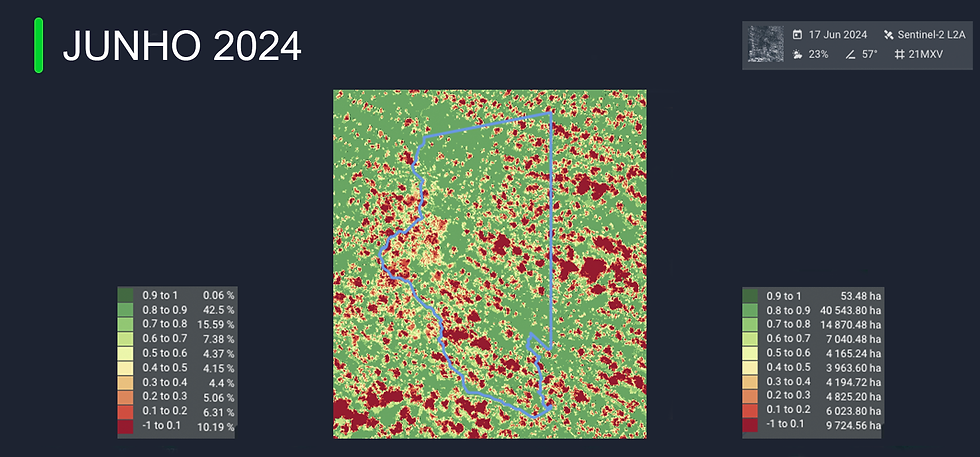
Deforestation Monitoring
Greenline monitors imminent deforestation risks and also the occurrence of deforestation if it occurs. We use a GIS platform
(Image Geoprocessing) where we slice the area into 50m x 50m quadrants for safer monitoring. Any change within just 1 quadrant will be identified immediately.


Density analysis


1/6


1/6
CO2 sequestration

1/1


bottom of page