

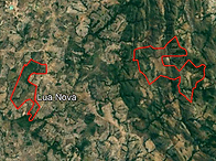
Ponta da Pedra Farm

Area Location


FIRM NASA
NASA's Fire Information for Resource Management System (FIRMS) provides near-real-time data on active fires using satellite observations.

(CMR) was developed to enable daily monitoring of occurrences such as deforestation, degradation, changes in land use and occupation in these territories.
Indigenous Area
Greenline does not allow the use of land areas that overlap any indigenous lands, therefore through the FUNAI Monitoring Portal, it is demonstrated and proven here that the land areas do not overlap indigenous lands .
Pigmentation Analysis and Carbon Sequestration
2023 - 2024
2023


2023


2023


2023
Year 2014 (January to December)
TOKEN ID: GimsWmndDqdsoibFPELj4faW4xtPcXZzo1nLPW3gqpGt
Name: GREENLINE-ESGU14
Quantity: 22,157.69 UNITS
Date of issue: JUN 2024


Year 2015 (January to December)
TOKEN ID: EtLXMY9QtRQoZKb78cYScWcDp9TeUQfdAparP7jGYxmi
Name: GREENLINE-ESGU15
Quantity: 23,772.81 UNITS
Date of issue: DEC 2024

