Area Location
The region is made up of humid forests with a predominantly warm and temperate climate with high humidity and hot summers.
It is part of the Tropical and Subtropical Moist Broadleaf Forests biome.

Indigenous Area
Greenline does not allow the use of land areas that overlap any indigenous lands, therefore through the FUNAI Monitoring Portal, it is demonstrated and proven here that the land areas do not overlap indigenous lands.

Deforestation Monitoring
Greenline monitors imminent deforestation risks and also the occurrence of deforestation if it occurs. We use a GIS platform
(Image Geoprocessing) where we slice the area into 50m x 50m quadrants for safer monitoring. Any change within just 1 quadrant will be identified immediately.

NDVI
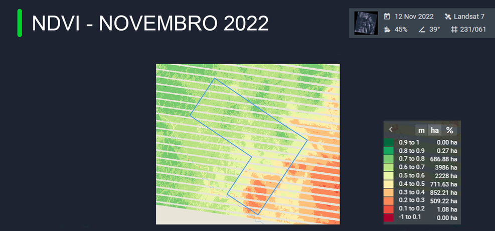
Normalized Difference Vegetation Index (NDVI) measures the health (greenness) and density of vegetation captured in a satellite image .
Healthy vegetation has a very characteristic spectral reflectance curve, which we can benefit from by calculating the difference between two bands – visible red and near infrared.
CGI
The chlorophyll index is used to calculate the total chlorophyll content of leaves. CIgreen and CIred-edge values are sensitive to small variations in chlorophyll content and are consistent across most species.
EVI
The Enhanced Vegetation Index (EVI) is an advanced vegetation index designed with increased sensitivity to biomass, atmospheric background, and soil condition. It is considered a modified version of the Normalized Difference Vegetation Index (NDVI) with high potential for vegetation monitoring, correcting all external noise. Vegetation indices are calculated from the bilateral reflectance of the surface that has been obscured by clouds, smoke, aerosols, water, cloud shadows, etc.
DMP SAMPLES
Dry Matter Productivity (DMP) represents the overall growth rate or increase in dry biomass of vegetation and is directly related to the Net Primary Productivity (NPP) of the ecosystem.


