top of page


Ponta da Pedra Farm

Area Location


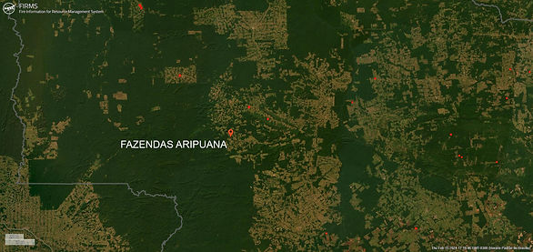
FIRM NASA
NASA's Fire Information for Resource Management System (FIRMS) provides near-real-time data on active fires using satellite observations.

(CMR) was developed to enable daily monitoring of occurrences such as deforestation, degradation, changes in land use and occupation in these territories.
Indigenous Area
Greenline does not allow the use of land areas that overlap any indigenous lands, therefore through the FUNAI Monitoring Portal, it is demonstrated and proven here that the land areas do not overlap indigenous lands .

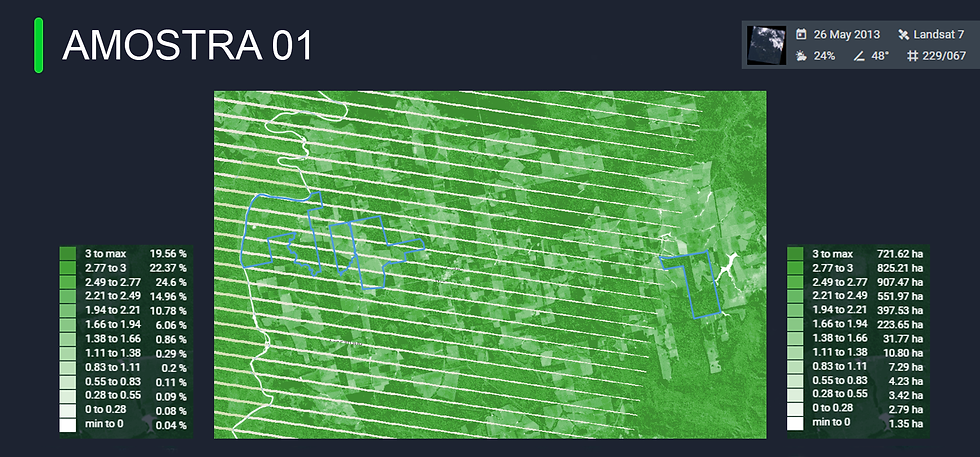
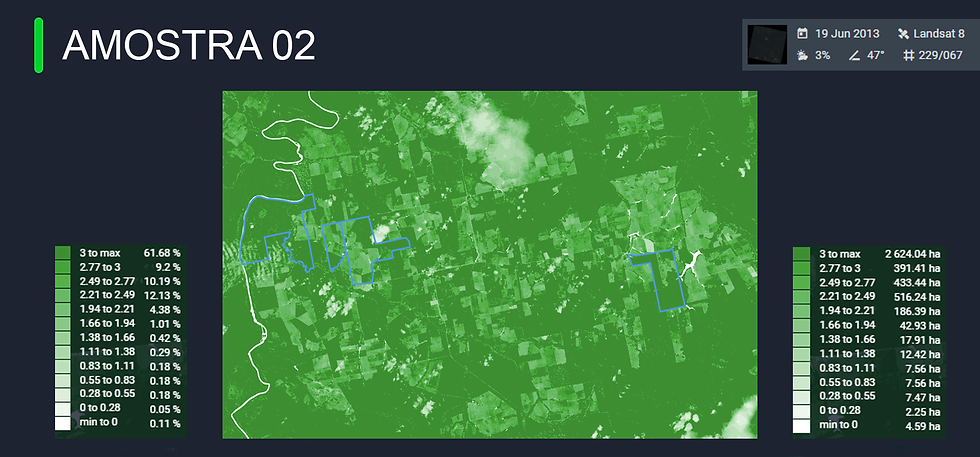
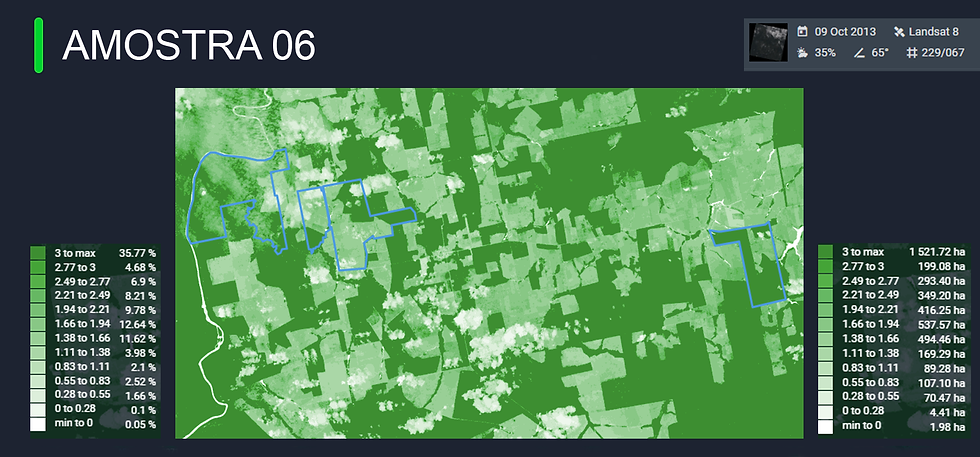
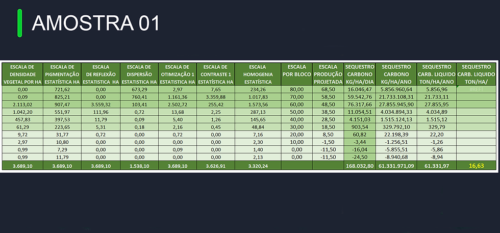
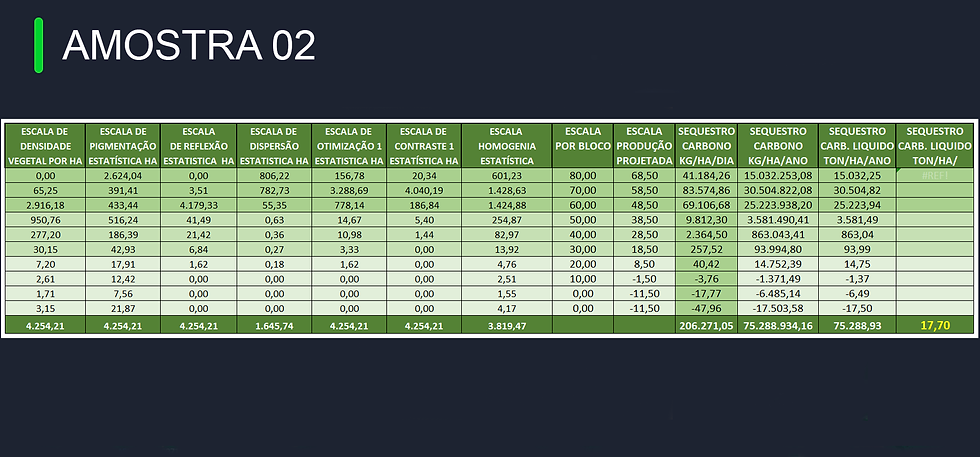
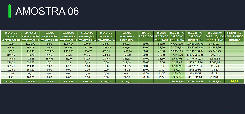
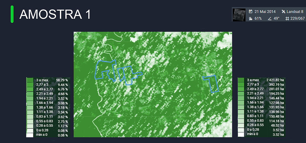
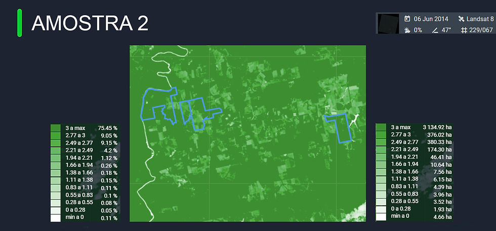
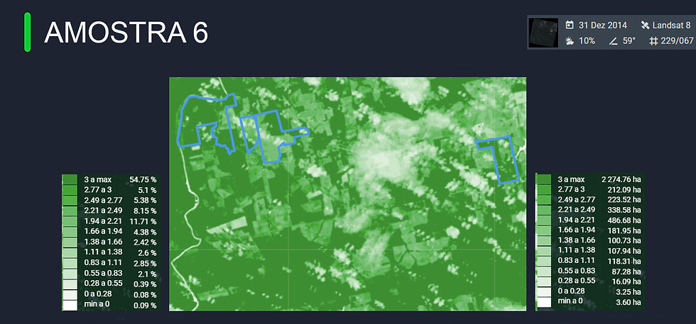
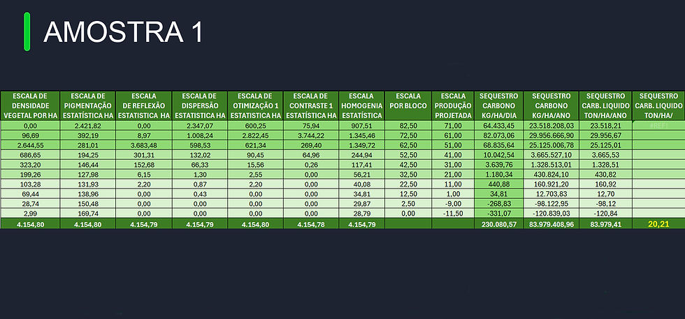
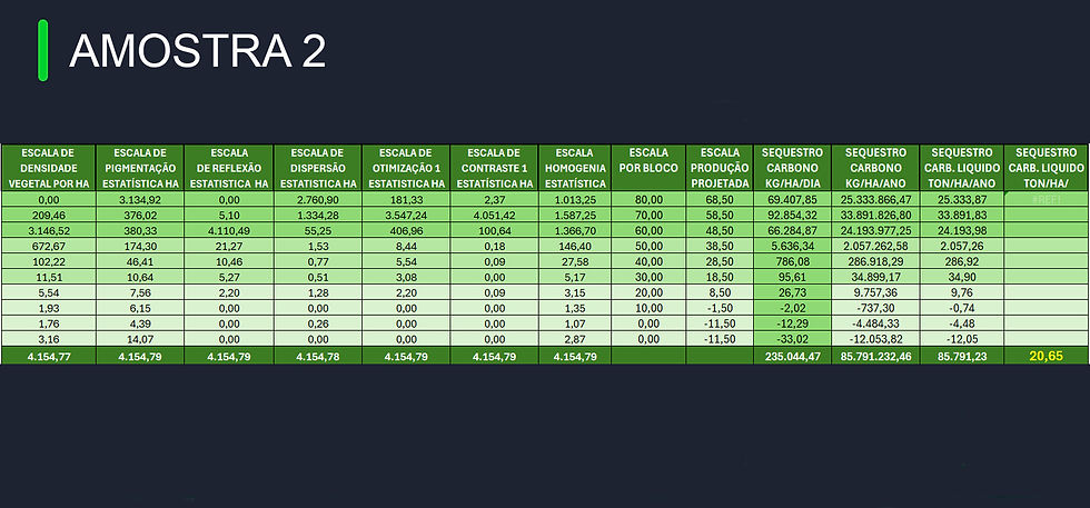
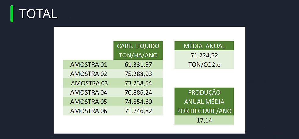
Pigmentation Analysis and Carbon Sequestration
2023 - 2024
Âncora 1
2023
1/6
1/6
2023
1/6

1/6
2023


1/6


1/6

1/3
2023
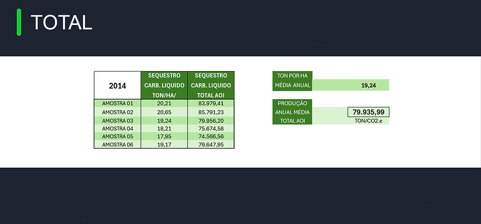
Year 2014 (January to December)
TOKEN ID: Ep95G3gxxVu6GcsF29RoS9fJqWbcW9bwq1jdZPDbTguN
Name: GREENLINE-MID14
Amount: 79,935.99 Credits
Issue Date: DEC 2024


bottom of page