

FAZENDA NOVO HORIZONTE

Area Location


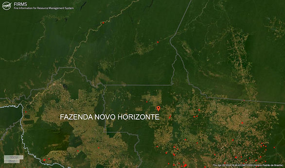
FIRM NASA
NASA's Fire Information for Resource Management System (FIRMS) provides near-real-time data on active fires using satellite observations.

(CMR) was developed to enable daily monitoring of occurrences such as deforestation, degradation, changes in land use and occupation in these territories.
Indigenous Area
Greenline does not allow the use of land areas that overlap any indigenous lands, therefore through the FUNAI Monitoring Portal, it is demonstrated and proven here that the land areas do not overlap indigenous lands .

Pigmentation Analysis and Carbon Sequestration
2023 - 2024
2023


2023


2023


2023


Year 2013 (January to December)
TOKEN ID: 7ChSdGA8P12ze1P8QotmR1xqBdivhHk35FKPYosrAkuR
Name: GREENLINE-NHO13
Quantity: 26,093.91 UNITS
Date of issue: APRIL 2024


Year 2014 (January to December)
TOKEN ID: PZne9Hx2D9S9JUF1Tadtc6pKEAU1WN4YQeAGouyCF3T
Name: GREENLINE-NHO14
Quantity: 27,526.42 UNITS
Date of issue: DEC 2024

