top of page


Greenline/Greensat Methodology
Text explaining the type of biome in the area
Jaborandi, Bahia
47655
Lat -13.8782
Lon -45.7465
Text explaining the type of biome in the area
Jaborandi, Bahia
47655
Lat -13.8782
Lon -45.7465

![FIRMS_7days[_-51.62,-17.89,9.19z].jpg](https://static.wixstatic.com/media/ccda4e_f17fba71b56144028e3368b9ebe12cab~mv2.jpg/v1/fill/w_586,h_310,al_c,q_80,usm_0.66_1.00_0.01,enc_avif,quality_auto/ccda4e_f17fba71b56144028e3368b9ebe12cab~mv2.jpg)
FIRM NASA
NASA's Fire Information for Resource Management System (FIRMS) provides near-real-time data on active fires using satellite observations.

(CMR) was developed to enable daily monitoring of occurrences such as deforestation, degradation, changes in land use and occupation in these territories.
Indigenous Area
Greenline does not allow the use of land areas that overlap any indigenous lands, therefore through the FUNAI Monitoring Portal, it is demonstrated and proven here that the land areas do not overlap indigenous lands .
Âncora 1

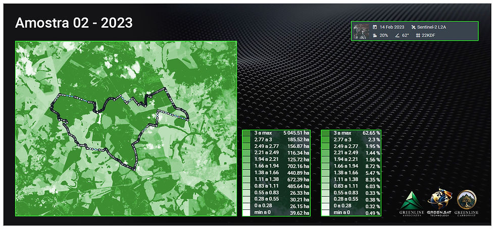
Pigmentation analysis
The Greenline ...


G01
1/12


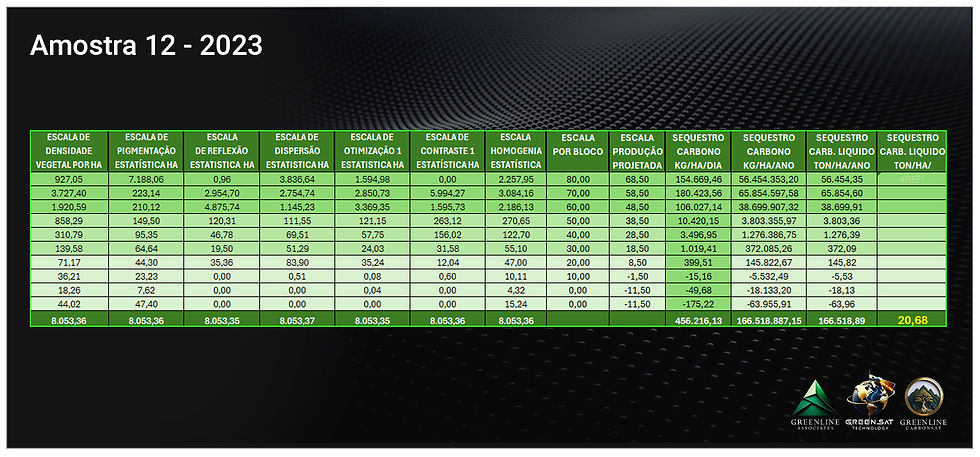
tabela_area_celular_2025_A12
1/12

grafico (5)
grafico (5)
1/1


bottom of page